

• View this cover story alongside photos.
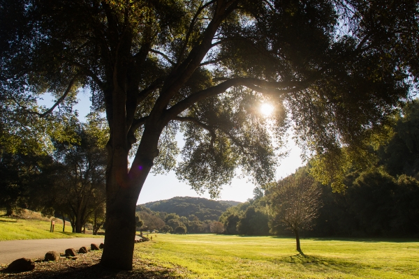
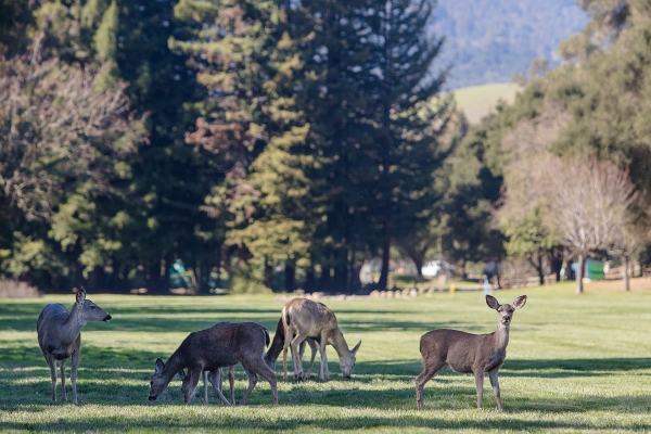
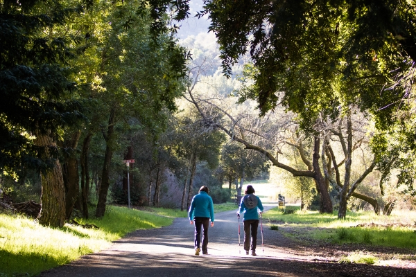
On a balmy, cloudless Friday, two hawks glide in circles over Las Trampas Valley while a herd of deer — eight in all — grazes in the shade. Serenity is only interrupted by the raspy, high-pitched whistling of a quail in the distance.
Formed by Buckeye Creek, Las Trampas Valley stretches from Orchard Glen near the center of Palo Alto's Foothills Park to the park's northeastern edge, where it bumps into the newest addition to the city's most glorious open-space preserve: 7.7 acres that the city inherited in 1981, re-discovered in 2012, and plans to open up to the public later this year.
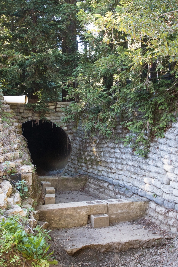
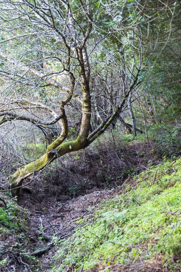
Las Trampas Valley also is where Buckeye Creek is at its most menacing. During heavy rains, water gushes from Wildhorse Valley downstream, through Las Trampas and ultimately toward the 7.7-acre parcel, where it deposits sediment and debris before flowing through a culvert into a neighboring property. Decades of downpours and erosion have taken its toll, and the dry creek at Las Trampas is now a canyon. A recent hydrology study commissioned by the city noted that in the mid-1970s, the deepest section of the creek was 7.4 feet below grade. Today it is 22 feet deep and — if nothing is done — heading toward 30.
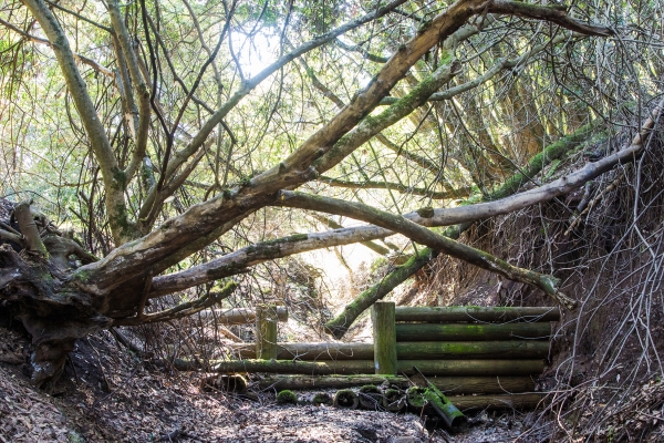
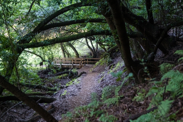
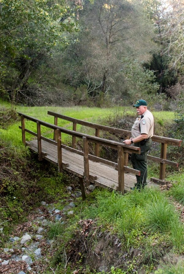
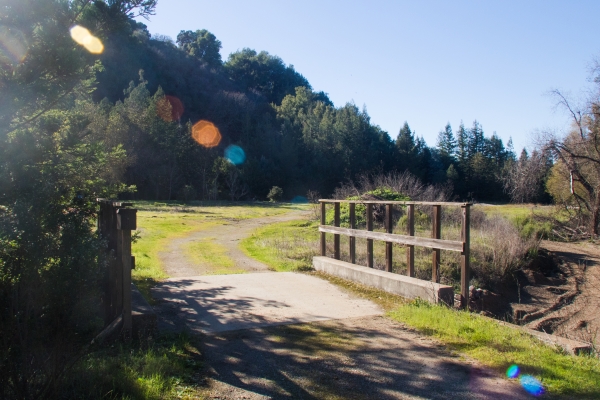
Man-made improvements around Buckeye Creek haven't withstood water's power. The footbridge spanning the creek is literally hanging on the edge. Much of the soil that once supported the footing on its north side has crumbled into the creek. The city's hydrology study concluded that if no action is taken, this bridge — and possibly others — will likely collapse in the next decade as the banks erode further.
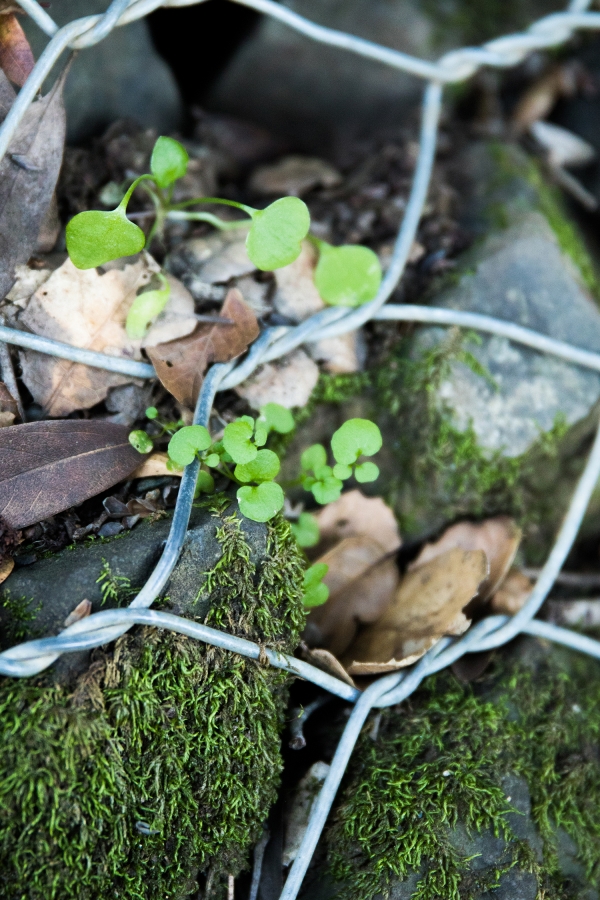
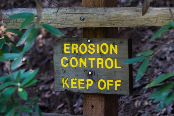
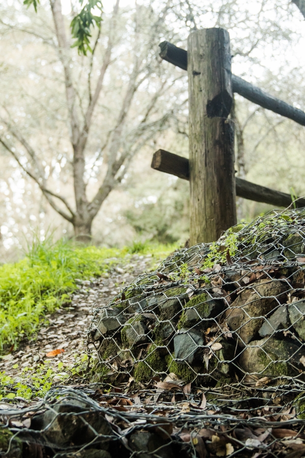
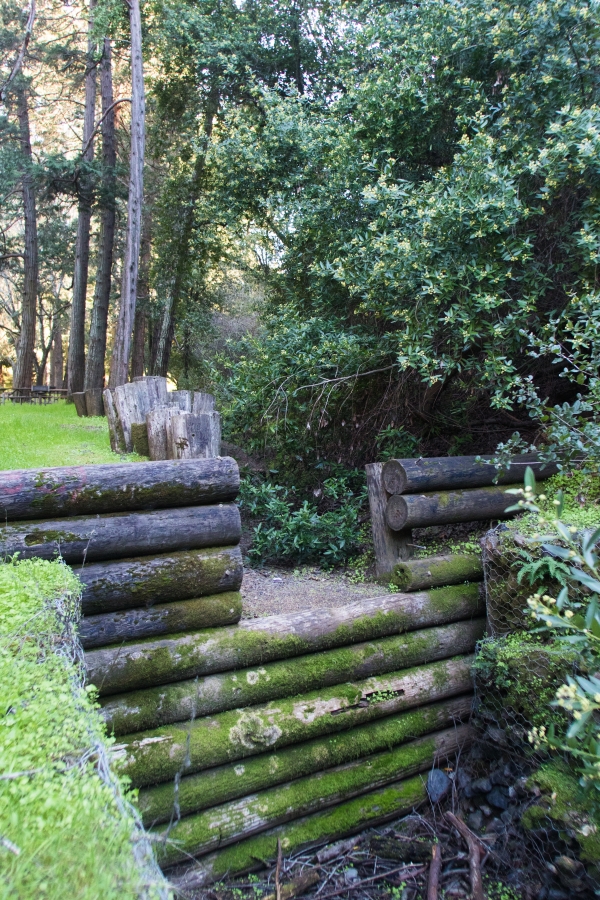
The timber barriers and "gabion baskets" (wire enclosures filled with rocks) that the city installed in the late 1960s and 1970s to stem the flow also are showing their age. The wire is "worn to the point of failing," the study states, and the barriers are "beyond their expected lifespan."
These problems are becoming increasingly urgent. The study by the engineering firm ENGEO concluded that unless the city makes near-term improvements, the existing structures and trail bridges will fail. What's more, "large areas of erosion will engulf portions of the Orchard Glen Picnic Area and portions of the existing 10-acre lawn area in Las Trampas Valley" and undermine the utility corridor in Wildhorse Valley, which includes water, sewer, electricity and fiber-optic connections.
The problems are in large part man-made. Long before the city purchased the 1,400-acre Foothills Park from the family of Russell Lee, property owners had manipulated the creek to support their agricultural needs. Buckeye Creek once meandered freely through the Las Trampas meadow where the deer graze today. Then, in the 1940s, the creek was re-routed to the side of the valley, where it remains today, according to Daren Anderson, manager of the city's Open Space, Parks and Golf Division.
But the new alignment narrowed the creek, reducing its capacity and causing problems in the downstream areas, Anderson said.
"During heavy storms, what would happen was water would flow down, causing the creek to downcut, causing erosion and sending that sediment downstream to various locations, most poignantly to the 7.7-acre parcel," Anderson said. "It can lead to flooding and obstructing of downstream culverts on private properties."
One way to address this problem, according to the report, is to restore the creek to its old, free-flowing ways. ENGEO recommended creating two large floodplains in the Las Trampas Valley and at the 7.7-acre site. In addition, the firm recommends rebuilding all the damaged grade-control structures — the timber barriers and rocky gabions — and creating a new channel in the upstream area of Wildhorse Valley to reroute the water flow and take pressure off the downstream areas. Altogether, the three-phased plan would cost about $9.7 million to implement.
For Palo Alto, which is already facing an estimated $50 million shortfall in its infrastructure plan, the report's recommendation is effectively a non-starter. But as the city is preparing to open the newest parkland to residents, officials are considering less dramatic — and less expensive — solutions along the creek.
The leading idea is to focus work in Wildhorse Valley, with the expectation that adding the new channel upstream and improved grade-control structures will solve the sediment problems at Las Trampas and the 7.7-acre site. The upstream portion alone, however, would cost about $3.7 million. With no funds currently budgeted, Community Services Department officials are banking on grants and other forms of outside financing to make the project work.
The Parks and Recreation Commission, which last month heard the results of the hydrology study, unanimously approved staff's recommendation to pursue the upstream work, as well as to budget $150,000 to design improvements to failing grade-control structures. In weighing the trade-offs, commissioners stressed the importance of protecting not just the creek area but the underground utilities.
The costs of doing nothing at all could be high, when one considers the flood risks and the costs of maintenance and future repairs. The city wouldn't really be saving money, Commissioner Keith Reckdahl argued — just delaying the expenditure. He supported moving ahead with work in the Wildhorse Valley.
"By spending the money upfront, we do it on our timetable. If we just wait, we do it on Mother Nature's timetable," Reckdahl said. "And Mother Nature always does things on more expensive timetables."
Comments
Green Acres
on Feb 23, 2018 at 7:59 am
on Feb 23, 2018 at 7:59 am
Let nature do it. No man made improvement anymore.
There are better places to spend City money!
College Terrace
on Feb 23, 2018 at 8:29 am
on Feb 23, 2018 at 8:29 am
Gosh can we just let nature be for once?
If it scares you stay away!
Crescent Park
on Feb 23, 2018 at 11:06 am
on Feb 23, 2018 at 11:06 am
Time to start charging an entrance fee again like they used to and use the revenue for improvements. Back in the 70s/80s my parents purchased a yearly pass to enter the park. I can't remember why the park entrance fee was discontinued.
Leland Manor/Garland Drive
on Feb 23, 2018 at 12:02 pm
on Feb 23, 2018 at 12:02 pm
I have to agree with letting nature take it’s course. But first, take out all the man-made barriers and bridges. Remove all tables etc that would get damaged by a flood and use in other parks. Close the areas of the park that are unsafe. Put up cameras to monitor the changes over a 1,3,5,10 year period and publish to PA residence and all Naturalists. Encourage PA residence to visit other parks to ensure Foothill will be undisturbed. We will probably see wildlife return and claim as a safe home! Mountain Lions could hunt without bothering the suburbs! $9 million to make more man-made improvements is a waste of money. Designate all extra money to PA District Schools. Pay the Teachers what they deserve.
Ventura
on Feb 23, 2018 at 12:37 pm
on Feb 23, 2018 at 12:37 pm
>>> rebuilding all the damaged grade-control structures — the timber barriers and rocky gabions
Sounds like a good maintenance project for Boy Scouts/Girl Scouts and other volunteers. Why make it so complicated, and who is profiting off of this sort of work?
Crescent Park
on Feb 23, 2018 at 3:40 pm
on Feb 23, 2018 at 3:40 pm
You cannot let nature take its course and have it work except in the largest
of ecosystems. There is no nature anymore as we once understood it.
Certainly not around herem and it is irresponsible to suggest that.
If Foothills Park burned to the ground, should be do nothing and just wait
how many decades to come back, if it ever did?
I think an entrance fee would not be a bad idea, or just a city park tax
that is for all our parks, or both. Post a budget and those responsible
for managing it too on a website somewhere. More transparency and
more eyes on any issue always helps.
Another Palo Alto neighborhood
on Feb 23, 2018 at 5:00 pm
on Feb 23, 2018 at 5:00 pm
I visit Foothill Park regularly.
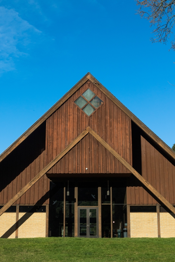
I wonder how much it cost to put the flag by the Interpretive Center? I have nothing against patriotism but was it a necessity?
There are many signs around the park about proposals to move the creek and other improvements. There are closed trails. The lake never seems to be low even during the drought.
I just wonder how much money could be saved and used for more essential needs in the park.