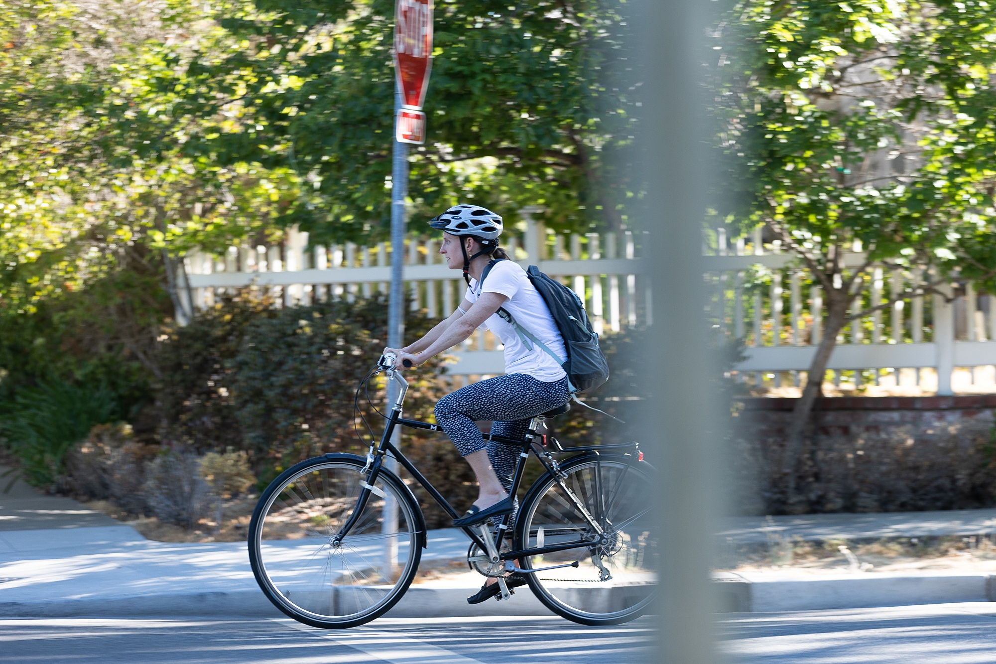

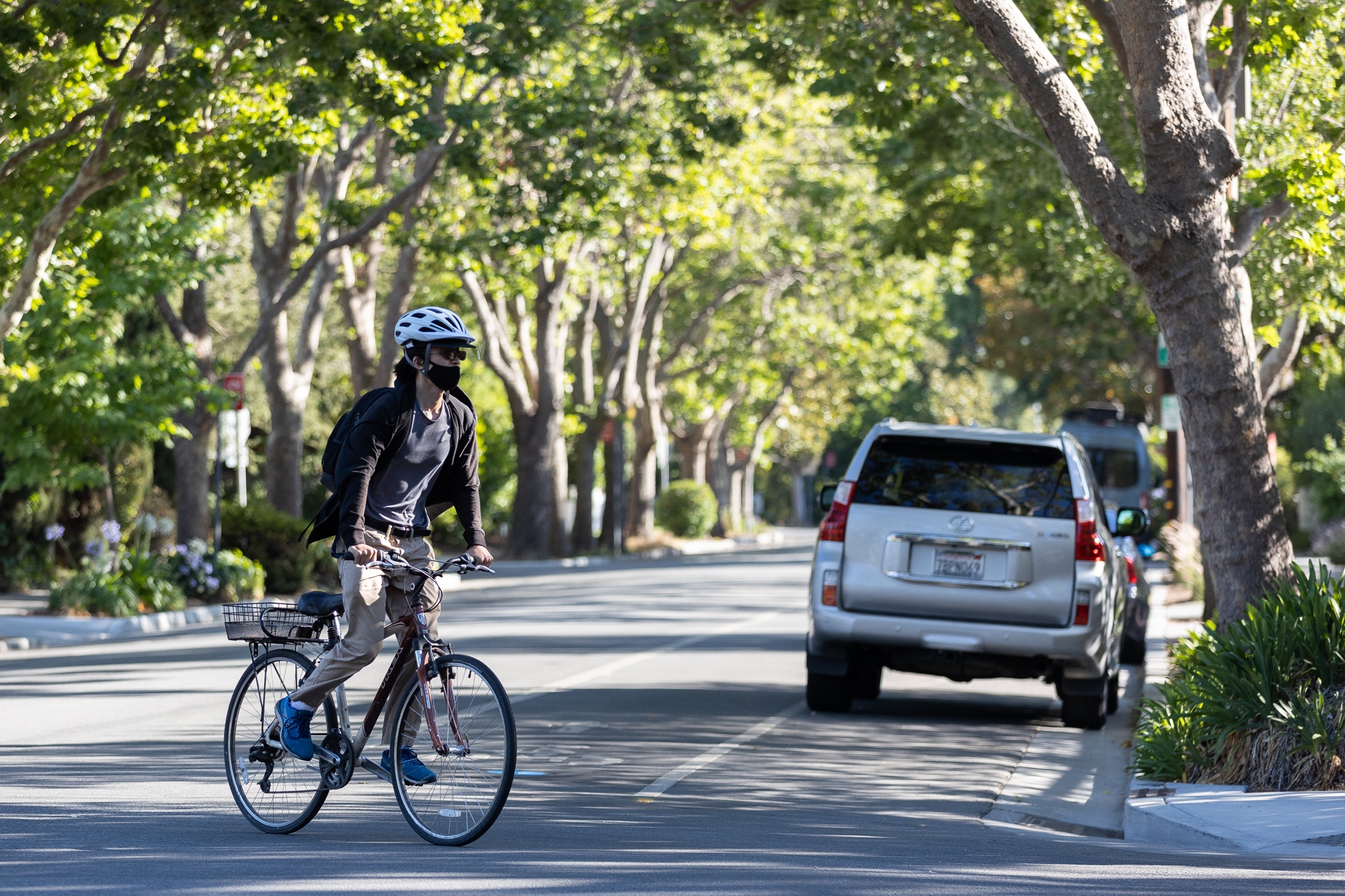
Few roads better epitomize the frustrations of Peninsula's bicycle advocates than El Camino Real, a critical north-south connector that offers both the most direct and, arguably, the most perilous route between Redwood City and Mountain View.
Living up to its moniker as "The King's Highway," the original connector between California's network of Spanish missions is today dominated by cars in just about every Peninsula jurisdiction through which it passes, despite years of talk around the region about converting it into a multimodal "grand boulevard."
And even as each city has been making its own bike-safety improvements (Palo Alto, for instance, is now completing construction of a bike bridge over U.S. Highway 101 as well as planning for further bike improvements along East Meadow Drive and on the Charleston-Arastradero corridor), these efforts have largely steered clear of El Camino.
A recent traffic analysis commissioned by city managers from Peninsula cities concluded that the 12.5-mile stretch of El Camino between Redwood City and Mountain View has a "high concentration of bicycle collisions" and virtually no bike infrastructure.
But even as it poses a steep challenge for city leaders across the Peninsula, El Camino also represents their greatest hope. During the pandemic, the cities of Redwood City, Menlo Park, Palo Alto and Mountain View collaborated on a Peninsula Bikeway study, a survey of bike amenities in each city with recommendations for further improvements to bike connections between the jurisdictions. The study, which was released in November, evaluates three different possibilities for separated bikeways that would stretch along the Peninsula. After considering other routes, including Alma Street and Middlefield Road, the study concluded that a bikeway on El Camino, despite the massive challenges it would entail, "represents the most viable opportunity to implement such a vision and help improve safety and connectivity for all bicycle users."
The Peninsula Bikeway study is an outgrowth of a partnership that city managers from four cities formed in 2016 to discuss stronger connections between their jurisdictions. Known as the Managers' Mobility Partnership, the effort initially focused on using existing bikeways and routes to design an interim "low-stress bicycle connection" between the north and sound ends of the segment.
The latest effort is far more ambitious. The new study bills itself as "the first phase of implementing a high-impact bicycle superhighway network in the Bay Area helping residents and workers increase connectivity and safety to jobs and activity centers." Its goal is to offer a "long-term, high-quality, bikeway suitable for bicyclists of all ages and abilities."
Unlike the interim route — a meandering path that forces riders to cross El Camino Real once and the railroad tracks twice to avoid hazardous road segments in the various cities — the new bikeway would be direct. All three of the study's options feature a straighter path between Redwood City and Mountain View. One would rely predominantly on Middlefield Road; another would stay within El Camino Real; the third would run along the Caltrain right-of-way and rely on Alma Street in the northern section and on Central Expressway and Evelyn Avenue in the southern end.
But El Camino was selected because it offers a "cohesive route" and has ample right-of-way to facilitate the improvements. Middlefield, by contrast, already has some bike lanes, but because they are not contiguous, bicyclists are required to maneuver and mix with car traffic, a challenge for less experienced cyclists. And Middlefield's existing right-of-way "would not allow for the implementation of a continuous and seamless separated bicycle facility," the study states.
The study also concluded that the Alma Street and Central Expressway route falls short because the corridors along that route "include fences, experience high traffic volumes and speeds, as well as multiple travel lanes making it uncomfortable for cyclists to traverse." And because there is no continuous bikeway north of Menlo Park, the route is "circuitous and not very functional," the study concludes.
But the study does acknowledge that El Camino comes with significant barriers: It currently has no bicycle infrastructure; and adding protected bike lanes here would more greatly impact parking, which in turn affects businesses that rely on El Camino for their parking spaces.
Any changes to the corridor's configuration, the study states, "will need to consider the trade-offs and potential effects on parking supply, loading/unloading, garbage pick-up, and other operational functions associated with retail businesses."
In the meantime, the study proposes a set of "interim improvements" that each participating city can undertake to its segment of the current Peninsula Bikeway. In Palo Alto, the improvements focus on Bryant Street and target the intersections of Bryant with East Meadow Drive, Embarcadero Road, Churchill Street and Lytton Avenue.
For the East Meadow intersection, the study recommends painted bulbouts to slow vehicles as they turn and "conflict striping" (a line of green rectangles for bicyclists parallel to the pedestrian crosswalk) to increase visibility of bicyclists.
Near Embarcadero, the study recommends high visibility crosswalks and green bike lanes near the intersection. At Churchill, the study recommends a traffic circle to reduce vehicle speeds. And on Lytton, the city should add a green "bike box" near the street's intersection with Bryant to improve bike connections between the two streets, the study recommends.
In Menlo Park, the study recommends improved signage and striping at the intersections of Elena Avenue and Valparaiso Avenue; Valparaiso and Crane Street; Laurel Street and Ravenswood Avenue; and Willow Place and Willow Road, an area where the study also recommends a "refuge island" at a place where there is currently a central turn lane.
The interim improvements proposed for Mountain View focus on the intersections of El Camino with San Antonio Road, Showers Drive, Rengstorff Avenue and Castro Street. The study calls for "high-visibility crosswalks" and protected intersections in these areas (marked with green paint and flexible delineators) for bicyclists and tighter radii for cars, designed to slow vehicle speeds.
The study acknowledges that even these steps are unlikely to sway a major segment of population to use their bikes for Peninsula commutes. Roughly half of the population of potential bicyclists falls into the category of "interested but concerned," according to a 2016 survey conducted by Jennifer Dill and Nathan McNeil. These bicyclists are interested in biking more but generally feel comfortable on streets with buffered or protected bikeways, according to the study.
"A bikeway with less separation such as a regular bike lane on a busy suburban arterial road with high speed traffic will fail to provide low-stress conditions needed to attract a majority of potential cyclists," the Peninsula Bikeway study states. "By appealing to the desire of the majority of users' needs … for increased separation, the implementation of a separated bicycle facility will help the community be strategic about investments and implementation, while also helping to balance competing network needs, such as for transit and freight."
Comments
Registered user
Community Center
on Jul 9, 2021 at 5:26 pm
Registered user
on Jul 9, 2021 at 5:26 pm
Why is the specter of risking children’s lives on a bike route through Palo Alto’s Middlefield Road threatening us again? A prior transportation manager described “consultant’s” studies that verified traffic conforms to the posted speed limit. This could only have been true if the posted limits permitted speeds often between 35 and 50 mph. Limited traffic barriers north of Oregon Expressway mitigate hazards to kids in the immediate three school’s vicinities. Congested traffic in the crowded, distracting, stimulus-rich regions of Middlefield with its commute corridor traffic, offices, municipal institutions and blind driveways would create a deadly hazard for bicyclists arriving and leaving en masse. I’m aware of two children hit by cars in one block over the last 40 years, one whom I witnessed riding a bike.
Wouldn’t a calming bicycle ride on Bryant be safer and more predictable for all?
Btw, I’ve never received an answer to what the City paid “consultants” for their studies.
Registered user
Greenmeadow
on Jul 9, 2021 at 7:27 pm
Registered user
on Jul 9, 2021 at 7:27 pm
El Camino isn't a city street, but it's a gravely mess. Right now, it's a danger to bikes just to cross El Camino at an intersection. The road is very rough, but worse: there are gravel piles that can wipe you out if you are not careful.
Registered user
College Terrace
on Jul 9, 2021 at 9:44 pm
Registered user
on Jul 9, 2021 at 9:44 pm
Montreal is a wonderful city for bike riding. It is possible to have a safe route on El Camino. I hope that can happen someday!
Registered user
Menlo Park
on Jul 9, 2021 at 11:16 pm
Registered user
on Jul 9, 2021 at 11:16 pm
El Camino would, because of its length and location, make a superb bikeway.
However, for that to happens one car lane in each direction would need to be converted into a physically protected bike lane and ALL driveway entrances to El Camino that do not have traffic lights would need to be eliminated.
Registered user
Greenmeadow
on Jul 10, 2021 at 7:25 am
Registered user
on Jul 10, 2021 at 7:25 am
@ Peter Carpenter
Your suggestion is highly impractical due to driveway accessibility factors and increased automotive gridlock.
Besides, why should ECR go out of its way to cater to bicyclists?
Registered user
Charleston Meadows
on Jul 10, 2021 at 8:28 am
Registered user
on Jul 10, 2021 at 8:28 am
Merchants along El Camino Real would raise holy hell if the boulevard catered exclusively to bicyclists.
Time to get real. Cars rule and commerce takes precedence.
Registered user
Ventura
on Jul 10, 2021 at 8:51 am
Registered user
on Jul 10, 2021 at 8:51 am
This is a laughable proposal that would be costly, unpleasant, and anger residents with more traffic.
Unpleasant:
El Camino is a wide concrete corridor. Even with a dedicated bike lane, it would be extremely unpleasant. There are already several great bike routes nearby, especially in Palo Alto with Bryant, Park, etc. These existing routes have shade trees, are far quieter, and already have critical mass of bikes using them.
Cost:
The state already can't seem to keep El Caminio paved to a suitable level. My kids have crashed/fallen off their bikes just crossing El Camino to go to school due to the massive potholes and disrepair of the road. This would be a boondoggle of years worth of construction making a few contractors big $$$ while snarling traffic.
Bad for Residents & Business Owners:
Removing 1-of-3 lanes on El Camino would make a major mess of traffic. It's a highway with lots of commuters and commerce. The right lane is often blocked by delivery trucks, customers backed-up waiting for Starbucks, etc. There are tons of under-improved intersections with un-protected left turns. How would those work with a two-way protected bike route? Barron Park might get almost completely cut-off from the city if those intersections' left turns are eliminated.
And don't even get me started on the many years this would take, all during which we'd have more traffic, road closures, construction, more accidents due to confusion, and more.
Instead, we should focus on cross-town (notionally East-West) routes that connect our bike corridors and neighborhoods with major employers. The new 101 bike bridge is a great step in the right direction.
Registered user
College Terrace
on Jul 10, 2021 at 8:58 am
Registered user
on Jul 10, 2021 at 8:58 am
Middlefield Road is a better option.
Registered user
Menlo Park
on Jul 10, 2021 at 10:21 am
Registered user
on Jul 10, 2021 at 10:21 am
Though noisier, motorcycles are better alternative transportation than bicycles as they are faster, more powerful, and you don't break a sweat.
After nearly getting killed a few times by errant motorists while riding my Colnago, I decided to sell it and ride an Indian motorcycle instead.
This proved to be a major improvement in the two-wheel roadway experience and one can cover a lot more distance as well...more fun too.
Registered user
Duveneck/St. Francis
on Jul 10, 2021 at 2:07 pm
Registered user
on Jul 10, 2021 at 2:07 pm
Ross Road-the sequel (on steroids) complete with bulb-outs, bollards, hundreds of gallons of green paint, lots of clueless consultants and administrators and planners salivating at the opportunity to really make a mess!
Maybe they ought to just send out five or six people on bicycles for a month or so every day to make their best way between Redwood City and Mountain View, then have them write up their choices and publish it in a glossy brochure. Get a better result and save a bunch of money.
Several years ago I commuted from near Channing and Middlefield to San Carlos and used mostly Middlefield with some side streets on my 10-speed and had no problems. Also earlier had commuted from same point to just the other side of Ellis in Sunnyvale also using Middlefield much of the way again with some side streets included. A super highway is of no special benefit as it is always going to take a route that jogs around to get to the final destination so just get on the bike and find your own decent way on streets that are comfortable.
Registered user
Greenmeadow
on Jul 11, 2021 at 2:00 pm
Registered user
on Jul 11, 2021 at 2:00 pm
> "Ross Road-the sequel (on steroids) complete with bulb-outs, bollards, hundreds of gallons of green paint, lots of clueless consultants and administrators and planners salivating at the opportunity to really make a mess!"
+Like
Ross road continually forces the biker and cars to weave together. Bryant is far better. Where exactly do these consultants come from and on what data do they design their roads?? Arastradero was also "improved" by weaving and I've seen three bad accidents as people have hit the obstacle course. At a minimum, no consultant or traffic engineer should be allowed to say anything w/o a minimum of say 12 hours bike riding over 4 weeks.
Registered user
Greenmeadow
on Jul 11, 2021 at 2:02 pm
Registered user
on Jul 11, 2021 at 2:02 pm
Elon's "Boring" company makes car-sized tunnels at a relatively affordable rate. Could you imagine making such a tunnel between these cities but having it with a few access points only for bikes, electric bikes and small electric carts? You cut transport times by a ton and increase bike and e-bike, e-cart many fold.
Registered user
Barron Park
on Jul 11, 2021 at 4:18 pm
Registered user
on Jul 11, 2021 at 4:18 pm
Forget about it. There are many who can no longer ride a bike and must use a vehicle to go anywhere. Bicycles on these routes are an invitation to disaster. Too many who ride bikes on the streets do not follow the rules. They do not stop at stop signs or red lights. This is an invitation to disaster.
Registered user
Adobe-Meadow
on Jul 11, 2021 at 7:40 pm
Registered user
on Jul 11, 2021 at 7:40 pm
I appreciate that the "bike" people have taken over the city. However ECR is a state highway. What happens on ECR is up to the state. What should be happening on ECR is fixing the bus stops to make them easier to function. If we are going to replace cars then we need busses to help do that. The majority of hotels and motels are on ECR. People who are visiting this city to attend events come in cars. SU is going to open up big time. PAHS will have team sports attended by visiting team parents. All of those visitors will be in hotels and motels for the time of the events. They can take the big bus down to SU and PAHS - add T&C. No parking issues. Go to dinner at T&C? Have a drink? Take the bus back - no parking and drinking issues.
I would like to see at Embarcadero a formal transit function - covered bus stops on both sides. Cut into the side walk to create space for busses to park while loading and not be in the lanes in transit. A location where the smaller busses can also wait - those going into the city - or going into the campus.
Who benefits? SU for one if the number of cars that need to park are reduced on game days. PAHS - same issue - less parking on game days. T&C - more business. Students - SU that live down further on ECR near San Antonio can get rides vs car parking.
We do not lack for bike trails through the city. We have them. If you have a bike then get off of the main streets - use the trails that are not in high volume traffic.
Registered user
Adobe-Meadow
on Jul 12, 2021 at 9:57 am
Registered user
on Jul 12, 2021 at 9:57 am
With the changes to 101 to a toll road ECR will get more use as a transit to SFO, San Mateo and RWC. THis is a road that needs more signage to prevent excessive parking - streamline this street for miximum useage by commuteers.
Registered user
Another Palo Alto neighborhood
on Jul 12, 2021 at 1:48 pm
Registered user
on Jul 12, 2021 at 1:48 pm
Speaking as a senior who mostly bikes for transportation, I am bothered by the previous comment that older folks can't bike. Nonsense! Use it, or lose it, I say. Biking regularly for short local trips (under 5 miles) helps me maintain my balance and strength and aerobic fitness. In short, I bike to keep happy and healthy...and it works!
I limit my time on ECR (a state highway, that is NOT controlled by the city) for lots of reasons. It carries 40,000+ motor vehicles/day which add congestion, smog that affects my lungs and safety issues that cars create everywhere they go. It's presently an AWFUL environment for biking. That said, I use parallel routes like Park Blvd. and connect to ECR within a block of my ECR destinations--my dentist, restaurants, friends who live in homes and apartments there, other shops, and (of course) Stanford U events).--so I do bike for short distances on ECR to ECR destinations.
I think that there needs to be wayfinding signage on ECR to help regional bicyclists find Palo Alto's existing calmer, safer, less polluted, parallel bike routes. ECR is the only alternative in some cities that don't have these routes, but we do. Let's help people who bike find them more easily! That won't eliminate the need for bike lanes on ECR to connect to to ECR destinations. I just don't think that these bike lanes need to be overbuilt for the kind of use that I describe.
Registered user
Another Palo Alto neighborhood
on Jul 12, 2021 at 2:05 pm
Registered user
on Jul 12, 2021 at 2:05 pm
The cost of parking cars is enormous. Consider the cost of land per square foot in Palo Alto. Consider that this valuable public land is being used to park cars. Consider that recent parking garage projects have ranged in price from $10 million to $57 million public dollars. This is a colossal subsidy supporting the habit of driving. That's JUST parking. It doesn't count the other massive infrastructure costs that support driving which the media never aggregates and reports. It would be eye opening to see a news report on how much Palo Alto actually spends on supporting cars vs. bike infrastructure. (Please include maintenance required by constant heavy wear and tear of motor vehicles, including cars, on street pavement in that calculation.)
Removing street parking on ECR to create room for bike lanes. Most of the ECR businesses have parking behind them that is underused. Few of them have bike parking (which is very challenging for those of us who bike there. It takes a lot less space to park bikes than to park cars. Hint. Hint.)
Bicycling is far less expensive to support. It takes less land, contributes zero greenhouse gas emissions and far fewer safety impacts on our community, and supports healthier lifestyles and bodies.
Registered user
Menlo Park
on Jul 12, 2021 at 5:47 pm
Registered user
on Jul 12, 2021 at 5:47 pm
Cut and cover a tunnel for Caltrain and use the existing tracks for a bike path. That would be amazing.
Registered user
Adobe-Meadow
on Jul 12, 2021 at 10:36 pm
Registered user
on Jul 12, 2021 at 10:36 pm
I was next to 101 later today and there was a big crash. THe whole place was at a stop. And if you were on the freeway you would be going nowhere. When they get the fasttrack up and going this is going to get worse. We need an alternate method to get up the peninsula and ECR is it. Putting a bike lane on ECR is the worst idea ever.
We have the giant buses on ECR - take a bus during the day is you don't want to drive.
People are taking a singular approach to this subject. ECR is where your hotels are - your shopping center, a medical center, SU events, T&C, PAHS events. People who are coming here are in Cars - not bikes. People staying at hotels are from other locations and got here by cars. ECR is where a lot of the city is making money - we hope. Any city manager who cuts off the ability for the city to put it's resources out there to make money is going to get fired. People do not invest in business so some other entity who does not even use the services gets in the way.
Registered user
Midtown
on Jul 13, 2021 at 11:07 pm
Registered user
on Jul 13, 2021 at 11:07 pm
This report was initiated under the previous city manager, and given to city council as an information report, not for discussion, in May. The current city manager did not send it to Planning and Transportation Committee (PTC), or discussed by the Ped/Bike Advisory Committee. I don't know of a strong local constituency to replace Bike network streets like Wilkie/Park/Casti/BikePath or Bryant with a city wide route on El Camino. At the same time, supporting local bike connections to destinations on El Camino are important. Shouldn't it be easier to get to the soccer fields by bicycle at Page Mill, or other mid-block destinations like Happy Donuts. I don't need to use El Camino to get cross town, but I'd like to have a bike lane, maybe a buffered one, to get to Happy Donuts from Ventura St.
Meanwhile the South Palo Alto Bikeways project is to be discussed by PTC on July 14. Good to pay attention to that.
Registered user
Adobe-Meadow
on Jul 14, 2021 at 9:56 am
Registered user
on Jul 14, 2021 at 9:56 am
Thank you Robert - you in part proved a point. Let's disrupt a street that is programmed for commercial ventures that produce tax revenue for the city - we hope - so the locals can go to Happy Donuts. That is like starting at the bottom of priorities instead of the top. One of the biggest concerns we have in this city is attracting business so we do not have empty store fronts. On ECR we have the bulk of the hotels and motels which are going to get used when the city starts up with all of the team sports and people who come from out- of-city to attend. The people who come to the events in the city go to restaurants, go to the local shops to buy stuff, and generally support the whole eceonomy - hopefully. All of the trade comes in cars. And if we can work it right they will leave their cars at the hotels and take the busses down to SU, PAHS, SSC, and T&C - a good place to go after a game for dinner and festivity. Most locals have already figured how to get around by bikes.
I can see carving out a path on the current ground level near the sports fields - but not on the actual ECR state owned Highway 82. That would be on city owned property - not state owned property.
Drive up ECR to MP - the whole place is under construction. RWC is under construction on ECR. It is all under construction because big business wants to invest in having an address on ECR. That is what drives revenue for the city that benefits everyone.
Registered user
Adobe-Meadow
on Jul 14, 2021 at 12:27 pm
Registered user
on Jul 14, 2021 at 12:27 pm
You are dealing with multiple cities here. ECR - west side from San Antonio to Los Altos Blvd - going north -is the city of Los Altos. You have major buildings here. On the east side on ECR - San Antonio going north to Adobe Creek you are in pieces of Mountain View. Check out an AAA map of the area that designates the city lines. SU is a separate entity for planning purposes - their bread and butter is the crowds who come to the games. Going north - MP is under heavy construction. Lots of opinions here and lots of approval required by multiple agencies.
As to Barron Park - go two blocks in and you are now in a very beautiful neighborhood. Large houses. New houses. What you see on ECR will not be there for long.
Registered user
Old Palo Alto
on Jul 20, 2021 at 1:13 pm
Registered user
on Jul 20, 2021 at 1:13 pm
Only time I have ever taken El Camino Real by bike was at 3AM, when there are hardly any cars. The road condition is terrible with ruts on the asphalt showing the embedded gravel beneath it. Leave ECR to the cars, but at least repave it. The road condition is terrible even with a car's suspension.
As for a path from Palo Alto to Redwood City, there are lots of options... Bay Trail to the north, Middlefield Rd/Old County Rd in the middle and AlamedaDeLasPulgas/Foothill Blvd in the south.
Registered user
College Terrace
on Jul 20, 2021 at 7:13 pm
Registered user
on Jul 20, 2021 at 7:13 pm
The problem is we are not like many cities in Europe where riding a bike, at any age, is very safe and common. We do have many bike riders in this city but we also have thousands of workers that drive into our city on a daily basis making it less safe for riders. I lived in Heidelberg Germany with my husband and two children and never had to use a car. The infrastructure is all set up for a life without a car. The train system from city to city is fast and affordable. So, it seems like here we are always running into roadblocks because of the existing car-dependent system we live in.
Registered user
Adobe-Meadow
on Jul 21, 2021 at 9:14 am
Registered user
on Jul 21, 2021 at 9:14 am
WE are not Europe. Our economy is not European. Reading Mr. Roadshow in the papers bikers are complaining about all of the car people who do not follow the rules at intersections, as well as the bikers who do not follow the rules at intersections. Given the multiplicity of our residents all have a different view of what biking is suppose to be.
I have observed at the Intersection of Louis Road and Charleston people start the lights to cross the street and people drive right through the lighted section. If I ever thought of riding a bike in this city forget it. Maybe in the country side where there are no cars. There are too many variables at work here. I do not see this city and other cities on the peninsula becoming a variation of a European city.
Registered user
Another Palo Alto neighborhood
on Jul 21, 2021 at 9:49 am
Registered user
on Jul 21, 2021 at 9:49 am
I recently drove along Arastradero/Charleston to come back from Foothill Expressway. Arastradero was a good choice. Charleston was not. It took me 3 green lights to cross at the tracks, nothing to do with a train, but just incompetent workers blocking lanes with no apparent work being done. It did strike me that Arastradero/Charleston is supposed to be a through route to Foothill Expressway and San Antonio is not ideal as it should be either. Page Mill, the other option seems to be far too much out of the way for south Palo Alto access to Foothill Expressway.
My other thought, is that since there are now so many streets where striping has been made for helping bikes, shouldn't now be the time where certain streets can now ban bikes. I have no objection of sharing the road with bikes on most streets, but there are certain streets where there are much better alternatives where they should be banned. Alma is one that comes to mind. With all the work done to promote biking on certain streets, banning them on others seems fair to me.
Registered user
Adobe-Meadow
on Jul 21, 2021 at 9:00 pm
Registered user
on Jul 21, 2021 at 9:00 pm
Streets are not generic. Some are reidential, some are commercial, and some are designated as mini-highways. Central Expressway / Alma is dedicated to moving people from point a to point b in the fastest way possible. No way should there be bikes on that street. Streets have a purpose and are designed to meet those purposes. Central Expressway / Alma is specific to purpose.
Registered user
another community
on Aug 6, 2021 at 5:37 pm
Registered user
on Aug 6, 2021 at 5:37 pm
Our city planners are still stuck in this flawed “bike route” mentality that only certain streets should be fixed, even though every city and county in the Bay Area and the state adopted Complete Streets policies over a decade ago. Complete Streets mandates fixing ALL of the streets for people of all ages and abilities to use all modes of transportation.
Complete Streets does not say fix only some arbitrary subset of streets and leave all the other streets such that they regularly injure and kill people. So there shouldn’t be any discussion now of which ONE mid-Peninsula route to fix. If it’s a public street, it needs to be fixed, period. And now, not in ten or a hundred years.
That said, it is refreshing to hear our city planners finally admit the painfully obvious fact that El Camino Real also needs to be improved, not just already super safe streets like Bryant. But El Camino Real is not going to get fixed until we elect more responsible city council members. Look what happened in Atherton in 2015 and Menlo Park in 2016 - city planners proposed very good bike lane plans for their sections of El Camino but they were shot down in 3-2 split votes by both city councils. Elections matter, and just hoping that the next generation of city leaders is going to be more responsible than those in power today is not an effective strategy.
Registered user
Adobe-Meadow
on Aug 8, 2021 at 7:04 pm
Registered user
on Aug 8, 2021 at 7:04 pm
I can't beleive that people keep talking about ECR - it is state Highway 82. It is the route for the giant VTA busses. What should happen on route 82 is first to repave it. I would hate to see someone on a bike on that street. Then cut into the sidewalks spaces for the busses to load and unload passengers so they do not stop commuters in that lane. At Embarcadero and ECR - both sides put in formal sitting areas with roofs so busses can wait and pick up people. Formal transportation centers where other, smaller busses for SU and PA can circle in an pick up people. T&C would benefit with more people coming that do not need to park. SU would benefit as people come to events and do not need to park. We need busses - not bikes on ECR. Why are people so single minded on this topic? Do they work for the RWC road people? We need a comprehensive plan that includes busses. Many people do not want cars now and cannot ride bikes.
Registered user
Adobe-Meadow
on Aug 9, 2021 at 8:07 am
Registered user
on Aug 9, 2021 at 8:07 am
Ross road is still a mess. The city needs to remove the the obstacle course, pave it over again, and restore the safe, wide street it once was, This continued obeisance to a very small, but very well organized collection of bicycle activists has to stop. We have real problems in this city the need to be addressed and a long distance bike trail through busy streets is not one of them.
Registered user
Barron Park
on Sep 6, 2021 at 4:30 pm
Registered user
on Sep 6, 2021 at 4:30 pm
@StarSpring 100% agree that Ross Road is a mess, and that full use of the available space should be made... it's insane how the bikes are expected to merge in and out of traffic when the roads narrow, and as many other cities around the world have shown would be much safer if the extra width were used to keep different modes of transportation separate -- a sidewalk for pedestrians, a protected or raised cycle track for bicycles, and a road for cars ideally with some continuous sidewalks for turning on/off of less busy side streets at points of conflict.
No need for a maze of concrete, use paint and make sure the lanes aren't excessively wide to help keep cars at the speed limit rather than 10-20mph above it (keeping kids in the area safer when they cross the street!) -- there are plenty of cities that have done this and shown that it reduces accidents, and reduces gridlock by increasing the number of short trips taken by walking or biking instead of driving (there's plenty of data from other cities showing that safer facilities lead to more people using the alternative modes of transportation). An additional upside with a separated bike lane is you won't get stuck behind a bike, since bikes are legally allowed to make use of the full lane right now (sharrows... bleh).
Another benefit of good bike facilities that people often forget is motorized mobility devices are allowed to use them -- making it easier for elderly or disabled people to get around who are not able to drive safely (or at all), which is perhaps counterintuitive in our society where we have a very "car-centric" mindset.
Registered user
Barron Park
on Sep 6, 2021 at 5:05 pm
Registered user
on Sep 6, 2021 at 5:05 pm
A crazy thought about ECR after looking at how other cities have transformed some of their streets, is that it could be a very vibrant street where you see people walking on the sidewalks going to businesses rather than a limited number of parked cars parked and empty sidewalks (re: the transformation of streets in Palo Alto and Mountain View when they closed them to cars during the pandemic but just along the ECR sidewalks).
The main issue is making it easy for people to get around, and making the businesses at ECR a place people would want to spend time rather than "need" to -- so the crazy idea: improve the sidewalk, add space for outdoor seating in areas, add a raised cycle track next to the sidewalk, ditch some street parking (need to look into more, but a quick trip down the street it looked like most businesses have parking around the back), and turn the right lane into a bus only lane.
Good sidewalks and bike lanes would make them appealing options for people (+ elderly/disabled with mobility devices) going to local businesses on ECR, coupled with a BRT system with frequent buses could get many cars off the road that currently sit in traffic jams on ECR.
Just as adding more lanes makes more cars appear to fill all available capacity, reducing the number of lanes makes traffic disappear (e.g. by encouraging trips via other means, that could also save us money on things like medical expenses), though the key is providing more appealing alternatives like a mass transit system that isn't stuck in traffic and easy options for getting from the transit stop to businesses.