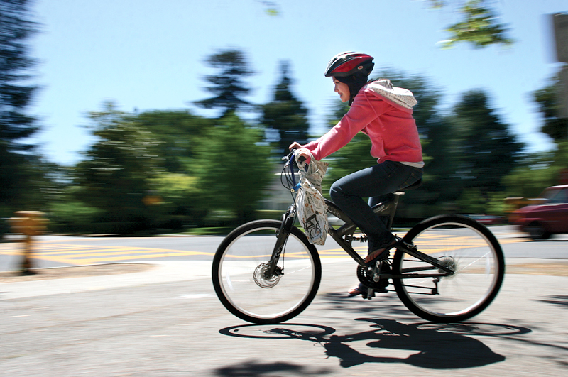

Crescent Drive residents probably don't need to read a countywide study to know that they live near one of Palo Alto's most dangerous intersections.
Just last month, as the city's Planning and Transportation Commission discussed new traffic-calming measures in a chronically congested and collision-prone segment of Crescent between University and Hamilton Avenues, Crescent Park resident Greg Welch called the historic interplay of cars and pedestrians in this part of the neighborhood "treacherous" and likened street conditions at the five-point intersection of Hamilton Avenue, Southwood and Center drives to a "demolition derby."
"People would rush in and there was no sense of: Who is supposed to go next? How do I make a left?" Welch told the commission at a June 14 public hearing.
The observations of Welch and his neighbors — 78% of whom supported the pilot project — are borne out in Santa Clara Valley Transportation Authority's latest analysis of high-collision segments and intersections. The Local Road Safety Plan (LRSP), which the VTA released in September 2022, gave University and Crescent a dubious honor: top ranking on its list of Palo Alto's high-collision roadways, which considers both the frequency and severity of collisions.
Other intersections on the list — in order from highest to lowest score — are El Camino Real and Barron Avenue; Middlefield Road and Oregon Expressway; Alma Street at Meadow Drive; and Embarcadero Road at Middlefield Road, according to the VTA report.
Collectively, these intersections accounted for 51 collisions between 2015 and 2019, the VTA report states. This included 16 collisions at Middlefield and Oregon; 11 at University and Crescent and 10 at Alma and Meadow.
Some caveats are in order. The analysis is based on pre-pandemic data and, as such, considers neither the shifting commuting patterns brought about by remote work nor recent road improvements like the one in Crescent Park.
In addition, city staff note that community engagement for the Road Safety Plan was limited and that equity considerations were absent from the county's analysis and recommendations. To that end, Palo Alto is now launching its own effort to identify dangerous intersections and explore needed improvements.
With the help of a $160,000 grant from the Federal Highway Administration, which the City Council approved on June 19, Palo Alto is preparing to develop a Safe Streets for All action plan, a two-year effort that will supplement the county analysis by surveying the public and conducting a fresh analysis of local road conditions.
Sylvia Star-Lack, the city's transportation planning manager, told this publication that the plan will "use collision data to identify the city's priority projects needed to enhance road user safety."
"The plan will also be informed by citywide community engagement efforts to understand road user experiences in Palo Alto," Star-Lack said in an email.
For the council, the new study is a central component of a "safe streets" policy that members formally prioritized in April after heavy lobbying by local bicyclists. The city's recently adopted Sustainability and Climate Action Plan also includes a "vision zero" policy that aims to "reduce injuries to all road users, particularly vulnerable road users" and to "reduce traffic injuries to zero."
Getting to zero
The VTA report suggests that Palo Alto has a long way to go to reach the "zero" ideal. The VTA report identified 1,802 collisions that occurred on Palo Alto roads between 2015 and 2019. Of these, 1,110 led to complaints of pain and 647 involved visible injuries.
According to the VTA, 45 collisions led to serious injuries and 10 led to a fatality. Nearly 90% of the collisions that involved pain complaints occurred at intersections, according to the report. Rear-end and broadside collisions were the most common, making up 35% and 33% of the total number, according to the analysis.
The VTA report also identified 555 collisions involving bikes and pedestrians over the study periods. Of the 416 that involved bicycles, 254 led to visible injury, the report states.
In addition to pinpointing the most dangerous intersections, the county's road plan also identified Palo Alto's most collision-prone corridors. The worst of the bunch is a 1.4-mile stretch of Oregon Expressway between Ash Street and just east of Louis Road, an area that saw 66 collisions between 2015 and 2019, according to county data.
It is followed on the list by four other busy commute arteries:
• El Camino Real, between Lambert Avenue and El Camino Way;
• Embarcadero Road between Byron Street and Newell Road;
• University Avenue between Crescent Drive and the eastern edge of the city; and
• Middlefield Road roughly between Portal Place and Garland Drive.
Some improvements at these high-risk areas are already being made. Around Crescent Drive, for example, the city has already implemented a traffic-calming project with a traffic island and new stop signs, among other things. Welch told the commission last month that these improvements have been effective at making things safer, and the commission agreed to retain them beyond the trial period.
Other changes are on the horizon. The county plan notes that the state Department of Transportation is preparing to repave El Camino later this year, which the agency indicated could include replacement of parking spaces with bike lanes all along the corridor. Caltrans has not yet released a formal proposal for the El Camino bike lanes, an idea that has proved polarizing in the past.
The county study also recommends targeted enforcement efforts at high-collision corridors where speeding and stop sign violations are common; an education campaign on the dangers of speeding and causes of rear-end collisions; and road features such as raised medians, splitter islands, raised pavement markers at intersections and flashing beacons.
Updating the city's master plan for bikes, pedestrians
Many of these improvements will also be explored as part of Palo Alto's update of its Bike and Pedestrian Master Plan, a 2012 document that has helped steer the city toward recent projects like the new bike bridge over the U.S. Highway 101 and new bike amenities in areas like Ross Road and East Meadow Drive.
Spearheaded by the consulting firm Kittelson & Associates, the new plan will rely on state and local data to analyze "the state of biking in the city of Palo Alto," according to the consulting contract. This will include information related to "demographics, commuting and travel characteristics, counts/activity, existing and planned pedestrian and bicycle facilities, access to transit stations, presence and availability of bicycle parking, Walk & Roll routes to school, comfort, safety, barriers and connectivity."
It will also examine pedestrian conditions and assess "major barriers and impediments to pedestrian travel," including sidewalk gaps, missing curb ramps and "presence of water bodies and rail lines that results in discontinuous routes."
Notably, the new plan will look at the impacts of the pandemic on transportation patterns.
"Information derived from this analysis will be used to identify specific locations for field review that require improvement, and possible enhancements in motorist, bicyclist and pedestrian awareness and educational programs, including at key locations such as downtowns, near and at transit stations, employment and schools," the agreement states.
For local bike advocates, the new planning effort offers a chance to advance new projects and revisit old debates. Eric Nordman, vice chair of the Palo Alto Bicycle and Pedestrian Advisory Committee (PABAC), said he hopes it will lead the city to reconsider its opposition to placing barriers on bike boulevards to separate cars from bicycles.
It was this policy, Nordman said, that hindered the city's efforts to create a bicycle boulevard on Ross Road, a project that proved so contentious that it forced city staff to effectively halt work on all other bike boulevards.
While many local residents complained about a new roundabout that the city installed on Ross Road, Nordman suggested that the bigger problem is the city's tendency to "squeeze" cars and cyclists together by installing bulb-outs and narrowing the roads.
Nordman said he wants the city to reconsider this approach and instead focus on creating bike expressways — streets where the configuration of stop signs and traffic lights enable smooth cycling with few stops and where barriers deter cars from speeding.
He also said he wants to see the city improve its east-west connections, which remain much more difficult than north-south. The city's recent effort to revamp the busy Charleston-Arastradero corridor took about two decades to implement.
And while the plan will explore other road improvements to improve safety for all types of commuters, Nordman suggested that this will prove challenging in south Palo Alto, where many neighborhoods were designed primarily for cars
"You can make improvements, but it's always going to be more difficult when you have these meandering roads that don't connect and major arterial roads where all the cars are directed to," he said.
Rather than simply focus on improving dangerous corridors and intersections, some bike advocates hope the new planning efforts will consider new bike routes that will allow cyclists to avoid these high-stress areas altogether.
Nordman cited the approach used in the Netherlands and in Scandinavian countries, where bicyclists and drivers are each steered toward road networks that are designed for their needs. Robert Neff, who also serves on PABAC, said he believes the city can do more to guide people to safe routes.
"I think that besides going through and figuring out what is the most dangerous place to be on a bike and how to fix it, I think we can do better on wayfinding and helping people figure out where the good routes are and making it something more obvious around the city," Neff said.
Comments
Registered user
University South
on Jul 19, 2023 at 10:22 am
Registered user
on Jul 19, 2023 at 10:22 am
Why isn't the crescent, Hamilton, Southwood intersection a roundabout?
Registered user
Palo Verde
on Jul 19, 2023 at 10:29 am
Registered user
on Jul 19, 2023 at 10:29 am
The city needs to be more proactive about San Antonio/Charleston. If we're relying on collision data to inform safety improvements, it will be only after a lot of housing has gone in South of San Antonio, so the "data points" will surely include actual kids getting maimed on their way to school.
The city has already committed to allowing thousands of apartments there. It shouldn't wait until after kids are getting hurt to start thinking about safety.
Registered user
Embarcadero Oaks/Leland
on Jul 19, 2023 at 10:35 am
Registered user
on Jul 19, 2023 at 10:35 am
You don't need an expensive study to realize that PA has created "demolition derbies" all over town with the constant lane changes, the odd "road furniture" and the narrowing / elimination of traffic lanes.
Of particular brilliance is putting bus stops 3 car lengths away from the Embarcadero Rd on Middlefield so traffic backs up INTO the intersection AND the bollards at every intersection prevent cars from going around the backups.
Of course Oregon and Middlefield are problematic because the bollards in front of Jordan prevent cars from bypassing other cars trying to turn left onto N. Cal Ave so cars get stuck in the middle of the Oregon / Middlefield intersection.
I've complained about both for way too long and watched our highly paid "leaders" and former Mayor Fine claim it's the other guys' fault and never acknowledging they created these problems while costing us a fortune in road furniture,bollards and useless consultants who can tell us we''re wrong when we alert them to obvious problems.
Extra credit to our 2 former traffic czars Mr. Rodriquez and Mr. Mello for their fail;ed community outreach, their skewed traffic studies and then THEIR outrage when they get caught trying to sneak through more nonsense while taking almost a decade to fix a hugely problematic traffic light.
And bonus point to the former city manager for awarding a multi-million $$$$ traffic light timing contract to the guy who couldn't fix that one light.
Registered user
Adobe-Meadow
on Jul 19, 2023 at 11:13 am
Registered user
on Jul 19, 2023 at 11:13 am
People have turned Middlefield and Alma into major commute time thoroughfares because El Camino is so horrible to drive on. Who would take a bike on the road? It is dangerous to your car so not a place for bikes. I do not understand why El Camino is totally ruined - and more so in PA than San Mateo County. However that is the road that is designated for major hotels, shopping centers, Medical facilities, and large condo projects. That is the one place that should be totally clear as to purpose - busses and cars to expedite traffic through the city. When visitors to the city come here that is the one road they recognize to navigate their transitions through their visit. That is the one road that shows up on maps that are telling people where to go. The safety of that road is attributed to it's total disrepair. It is no place for people in bike lanes.
Where is the City Manager in all of this discussion? He is responsible for the business base of the city. The business base designates where major facilities who pay major income for the city are situated. If you confound hotels, restaurants. medical centers with confusing road impediments they will go somewhere else. How much of the city income comes from the different locations in the city.
Are you all forgetting that we now have a Bay Trail that totally encompasses the cities surrounding us. There is a bike bridge off the Bayshore East that is closer to the Embarcadero Road that is more heavily used then the one that is close to San Antonio. Also one that goes into the EPA Home Depot.
Charleston has been totally changed so you have a cross city connection in the south side. The people on bikes should not expect that the city is totally rewritten as to the purpose of the various locations to suit their individual desires. Common sense should prevail here.
Registered user
Community Center
on Jul 19, 2023 at 11:36 am
Registered user
on Jul 19, 2023 at 11:36 am
The absence of a decent E-W route results in the overloaded connections to US 101.
University Av from Crescent to 101 should be widened, and traffic split into 2 one-way corridors, eventually Lytton and Hamilton.
Any changes in routing to reduce congestion and pollution will cause push-back from homeowners along the affected streets. However, the entire community would benefit.
Registered user
Embarcadero Oaks/Leland
on Jul 19, 2023 at 11:56 am
Registered user
on Jul 19, 2023 at 11:56 am
"The absence of a decent E-W route results in the overloaded connections to US 101."
Just wait and see what 5 years of constriction at Casti and Embarcadero will do to those connections.
Bonus points for closing Churchill at the same time.
Do our "planners" and "leaders" ever communicate with each other? Are they deluded enough to think that fewer than 4 cars back up at the Middlefield/Embarcadero light, esp. now that they've eliminated the dedicated right turn lane from Middlefield S onto Embarcadero W?
Registered user
Leland Manor/Garland Drive
on Jul 19, 2023 at 12:05 pm
Registered user
on Jul 19, 2023 at 12:05 pm
The Newell Road and Seale Avenue intersection is also dangerous. There is a lot of bicycle traffic as students ride to and from Greene Middle School. There is a stop sign at Seale. There is not one at Newell.
Registered user
University South
on Jul 19, 2023 at 12:22 pm
Registered user
on Jul 19, 2023 at 12:22 pm
I think they’ve missed quite a few.
Lincoln and Middlefield
Channing and Cowper
Homer and Cowper
Just to name a few.
Registered user
Crescent Park
on Jul 19, 2023 at 12:37 pm
Registered user
on Jul 19, 2023 at 12:37 pm
The city should not need the VTA to tell them where the traffic problems are. Residents have lobbied for years for fixes to the locations listed in this piece as well as other locations. The city should establish a resident-led task force to identify and prioritize the road sections to be addressed. The other priority for the city should be to find a way to get better data. Neighbors who worked on the North Middlefield redesign studied accident data from the SWITRS (statewide integrated traffic reporting system), the most used data source for California traffic accidents. They found that 3/4 of all accidents go unreported and hence uncounted. Residents can provide much more complete data reporting than the state's current system.
Registered user
Embarcadero Oaks/Leland
on Jul 19, 2023 at 12:47 pm
Registered user
on Jul 19, 2023 at 12:47 pm
@jguislin, excellent points. Why trust an organization that puts a bus stop 2 car lengths from a major interection (Middlefield and San Antonio W) and can't / won't repave El Camino in a reasonable time frame??
Just do a search here on "Middlefield" and look at all the articles on misguided policies: lane reductions to slow traffic aka create traffic jams, having to redo the configuration of traffic islands and the classic Web Link Middlefield A Roadway Odyssey Palo Alto Style.
Just to name a few.
Registered user
Another Palo Alto neighborhood
on Jul 19, 2023 at 1:16 pm
Registered user
on Jul 19, 2023 at 1:16 pm
Just as an observation, the Middlefield/Loma Verde intersection is much less dangerous since the fire closing the 4 businesses. No more double parking (or cop cars or fire dept trucks) while drivers go in for coffee and no more pedestrians running out with coffee cups to catch the light. Also no back ups as cars try to get into Philz parking lot.
(Yes I know someone is counting the number of times I mention this fire, but it is relevant).
Registered user
Barron Park
on Jul 19, 2023 at 2:02 pm
Registered user
on Jul 19, 2023 at 2:02 pm
@jguislin - Re: "They found that 3/4 of all accidents go unreported and hence uncounted. Residents can provide much more complete data reporting than the state's current system."
Unofficial data is seldom likely to drive the desired changes. *Reporting* all the accidents when they happen is the way to get the data into the official record thereby making it available to all the interested parties.
Registered user
Barron Park
on Jul 19, 2023 at 2:14 pm
Registered user
on Jul 19, 2023 at 2:14 pm
The 5-way intersection at Hamilton/Center/Southwood looks like a roundabout -- but it is not signed that way. It should be, which would give everyone the hint they need in order to make their turns correctly. All-way stops are NOT going to improve the confusion once people get into the intersection.
Registered user
Green Acres
on Jul 19, 2023 at 6:22 pm
Registered user
on Jul 19, 2023 at 6:22 pm
Re: "Normand suggested that the bigger problem is the city's tendency to "squeeze" cars and cyclists together by installing bulb-outs and narrowing the roads."
It's not just a tendency, it's a deliberate policy to make drivers feel unsafe so they hopefully slow down. You can see how poorly that's worked on Arastradero, where most of "traffic calming" islands and bulging curb sections have black scuff marks or even concrete broken away from cars repeatedly running into them.
Registered user
Adobe-Meadow
on Jul 20, 2023 at 10:33 am
Registered user
on Jul 20, 2023 at 10:33 am
3AM - I get it. El Camino has been deliberately left in disrepair to create safety problems that a "consultant" will fix with bicycle paths. When you pay a consultant you tell them what the result is suppose to be. The disrepair on El Camino makes no sense. When you cross over to Meno Park the road is okay.
Who is in on this? The City Manager? Berman? Simitian? Who interacts with Caltran to talk them into this?
The credit union left to go to Los Altos. Who else has left? The Fish Market. What about the major builds that are going to take place at Fry's and the other side of the street with the major hotel - Creekside?
The major additions to our Housing plan are going on here on El Camino. This bicycle action is disrupting the whole development plans for the city and affects our tax base. If you repave the street and put busses there for commuters you have solved your problem. You will also help the hotels which are starting to look shabby. The tourist that come here for the SU games and business are not riding bicycles. El Camino is a major highway whose job is to facilitate business and move people. Cars and busses.
For all of those people who complain because they can't get to Happy Donuts - maybe Happy can move to a shopping center. I am sure that they can use more business.
Registered user
Midtown
on Jul 20, 2023 at 10:50 am
Registered user
on Jul 20, 2023 at 10:50 am
It is Eric Nordman. Thanks for the article.
Registered user
Palo Alto Weekly staff writer
on Jul 20, 2023 at 12:18 pm
Registered user
on Jul 20, 2023 at 12:18 pm
Thanks, Robert. Sorry for the error, which has been corrected.
Registered user
Duveneck/St. Francis
on Jul 20, 2023 at 12:32 pm
Registered user
on Jul 20, 2023 at 12:32 pm
A few observations:
- I agree with a poster above that remaking El Camino Real to squeeze in bikes seems to be a really risky thing to do. I would repave El Camino Real (which it needs ASAP) with full acknowledgment it’s a major inter city throughfare for motor vehicles, including busses.
It should not be reformatted for bikes; this is a sheer fantasy that bikes will rule the peninsula.
Squeezing vehicular traffic down to fewer lanes to “punish” drivers is illogical and misguided. I certainly hope our local politicians who know better will stop the state’s foolish plan for bikes there.
Note: I have nothing against bikes; I’m just practical and realistic and want safety for all as well as certain major direct routes for motor vehicles.
- It takes too long to drive through Embarcadero/Middlefield. This is a major route into Palo Alto. It ought to work efficiently as one.
Also:
Pretending or wishing everyone to be on bikes on this narrow major oldtime thoroughfare (Embarcadero Rd) with narrow sidewalks is unworkable.
I both drive this major route and walk on the sidewalks along it.
- The dry, unsightly brush/weeds at 101/Embarcadero (on all sides of this major intersection) should be fully removed and cleaned.
This would improve sight lines of drivers exiting the freeway, reduce fire risk, so please, politicians, arrange to regularly remove unsightly trash and weeds and make a nice gateway entrance into Palo Alto.
Is this SO difficult to do? What on earth do visitors to Stanford think as they exit here amid dry weeds to go up to Stanford!?
Registered user
Another Palo Alto neighborhood
on Jul 20, 2023 at 3:10 pm
Registered user
on Jul 20, 2023 at 3:10 pm
Alma should be made into a continuation of Central Expressway and the intersection with Sand Hill should be improved. This would efficiently move a lot of the through traffic off Middlefield and El Camino which would also help non-through traffic move efficiently.
Trouble is, nobody seems to want traffic to move efficiently. Instead, any way of snarling up traffic seems to be the goal.
Registered user
Adobe-Meadow
on Jul 21, 2023 at 8:29 am
Registered user
on Jul 21, 2023 at 8:29 am
On the 7PM NBC news last night was a rep from Caltrans who provided a presentation on how many people have been killed by city on El Camino. At 11PM the focus was on Atherton with film on the shabby treatment of the street - no sidewalks, no protection to walkers, few stop signs. Interview with the Mayor of Atherton. ECR in Atherton is Dogpatch. That is San Mateo county. Menlo Park is okay as to number of street signs and paving. The presenter is on a crusade.
Questions are who in Santa Clara County is responsible for roads. How is comparison made by city as to active business base of entities on the street. Our city has a major sports arena, medical center, shopping centers, hotels, condos, small businesses. Comparisons by city needs to be questioned.
Registered user
Ventura
on Jul 25, 2023 at 2:20 pm
Registered user
on Jul 25, 2023 at 2:20 pm
How did the Palo Alto Planning and Transportation Commission and VTA decide which intersections were the most dangerous? If it was purely the statistics regarding how many accidents happened at those locations, then they are going to have a difficult time reducing the numbers without a known cause.
On Meadow/Alma I would say driving behavior is the primary cause of accidents and not the streets themselves. I regularly hear the same vehicle racing up and down the street - sometimes its a car and other times it's a motorcycle. I have also seen drivers that are so impatient to make the light, that they are willing to stop on the train tracks.
Registered user
Duveneck/St. Francis
on Jul 26, 2023 at 7:31 pm
Registered user
on Jul 26, 2023 at 7:31 pm
Yes, the current configuration of the intersection of Alma, ECR and Sand Hill has to be amongst the top ten that should not have been agreed to; I recall Menlo Park didn’t want Palo Alto traffic. .
…Well, struggling through ECR in Menlo Park IS certainly slow and dreadful - so I’m discouraged from visiting and spending $ in Menlo Park - but I really think the above three streets should align for common sense and smooth movement of vehicle and bike traffic in the region. There is only so much hatred of vehicles (by some local politicians) that we can allow….sheesh.
Registered user
Another Palo Alto neighborhood
on Jul 29, 2023 at 6:20 pm
Registered user
on Jul 29, 2023 at 6:20 pm
Robert Neff, who also serves on PABAC, said he believes the city can do more to guide people to safe routes. "I think that besides going through and figuring out what is the most dangerous place to be on a bike and how to fix it, I think we can do better on wayfinding and helping people figure out where the good routes are and making it something more obvious around the city," Neff said.
Very well said. Palo Alto has many wonderful north/south bike routes. East/west connectivity is lacking for bicycles--especially south of Oregon Expressway. On my bike, I generally choose quieter routes to get to El Camino destinations. (Park Blvd is a favorite for me.), and then I use a quiet neighborhood street to cut over to the El Camino block of my destination. I'm a pretty skilled and careful bicyclist, and I find the state highway to be an awful place to ride. I don't think bike lanes--even protected bike lanes-- will fix that. Aside from the lack of bike facilities, the sheer volume of motor vehicle traffic with its noise, fumes, and associated risks makes it thoroughly unpleasant. I'm not sure bike lanes will entice me to ride there for any distance. Improved bike boulevards in that area (parallel to El Camino and connecting to it) would be great!
I join Eric Nordman in his curiosity about the causes of the crashes at these locations. What were road users doing when these injury collisions occurred? That matters. Were they crossing the highway? Making a turn? Taking a lane? Overtaken going straight? Broadsided while riding straight at a cross street? Bike lanes may help, but understanding the problems usually enables better problem-solving. What conditions and behaviors caused these crashes? Knowing that will help us solve the specific problems that are leading to injuries and deaths.
Registered user
Adobe-Meadow
on Aug 1, 2023 at 10:15 am
Registered user
on Aug 1, 2023 at 10:15 am
ECR has planters in the middle at some locations. Also cement dividers. All put there to keep everyone on their side of the streets with cut-ins for turn lanes. You all keep trying to manipulate what has already been put there. What we need to manipulate now is getting the street repaved so everyone will be safer.
My car says it does not want to go down that street because it's tires and understructure have already racked up repair costs. My car hates that street. However in San Mateo County the road is paved. San Mateo County is okay. Sants Clara County not okay. How can that be?
Registered user
Adobe-Meadow
on Aug 8, 2023 at 11:53 am
Registered user
on Aug 8, 2023 at 11:53 am
More on this topic from the PASC meeting 08/07 - discussion of the addition to the PA Commons Retirement home next to the Goodwill Store on El Camino Way. One of our two new PA members suggested that Commons provide bike racks so the seniors can go biking. Very busy here promoting biking as a way to navigate the city. Note - the seniors here are transported by busses to their activities.
Note that the driveway for the Commons is directly next to the Goodwill driveway to their parking lot. Goodwill is busy all day and night when open. The entry and exit to their parking lot is chaotic. El Camino way is a street used to move off El Camino to the lower residential cross streets and is always busy - also narrow one lanes each way.
So why would any one let seniors go biking in the most chaotic set of driveways? Commons could be sued for negligence.
It was noted that the people who work at the Commons use public transit to get there due to limited parking. That is public transit on ECR.
Each PASC member is using their favorite activism topic to insert into the planning for the city - whether it makes sense or not. We are getting the member's agendas now. Pay attention to what activities they are pushing. And just say NO.
Registered user
Downtown North
on Aug 9, 2023 at 9:46 am
Registered user
on Aug 9, 2023 at 9:46 am
Slowing down the speeds to 25mph would allow for better reaction & response time on the part of drivers and provide added safety for bicyclists and pedestrians.
And for those who decry this suggestion as too slow & impractical, just leave earlier & don't be in such a hurry to get to wherever you are headed.
Registered user
Stanford
on Aug 24, 2023 at 10:48 am
Registered user
on Aug 24, 2023 at 10:48 am
The construction of the Blake Wilbur Drive extension from Welch Road to Sandhill, across from Stanford Cancer Center is extremely dangerous for pedestrians. Ambulance and car traffic have greatly increased due to the ER at Welch and Pasteur Drives. The median strips are an ambulance obstacle: ambulances are now using the wrong lane in order to bypass traffic due to the high median.